
Build a route
Lasso the doors on the map
Section titled “Lasso the doors on the map”The lasso lives on Voters → Map, the only view that plots individual voters. It shares one filter bar with the voter table, so a lasso selects from exactly what the map is showing.
- Open Voters and switch to the Map tab.
- Use the filter bar to narrow by tier, party, precinct, or LD.
- Click the lasso control on the map, then drag a shape around the doors you want. The selected count appears above the map.
- Click Create Routes.
- Set doors per route and a name prefix. The modal proposes the split and shows each route’s doors, turf, and estimated hours — nothing is created until you confirm.
- Assign a canvasser afterwards from the route, or leave it unassigned.
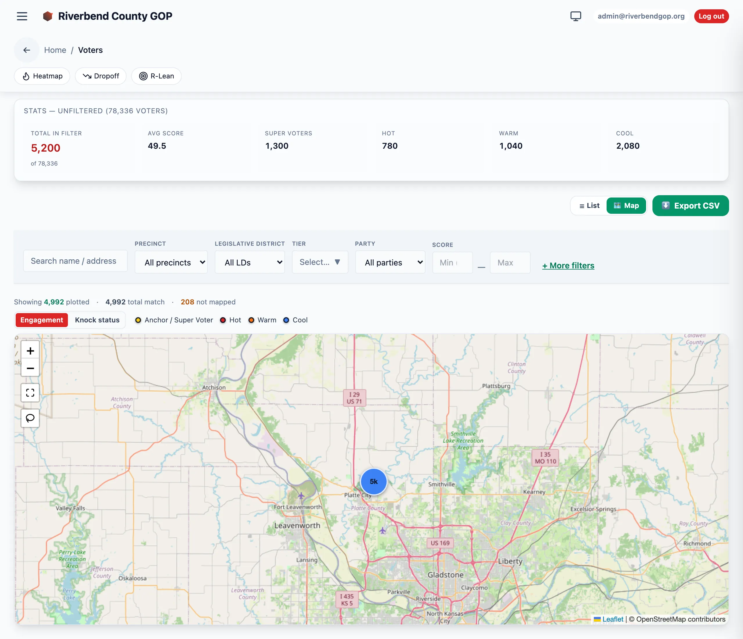
Voters → Map, where the lasso lives. The footer above the map is the one to read before you drag: it reports how many voters are plotted, how many the filter matched, and how many have no coordinates to plot.
Route size
Section titled “Route size”A route here is a block, not a shift — the routes in the field average about 11 doors and under an hour. Doors per route defaults to 12 for that reason. Estimated hours are derived from door counts and are a planning aid, not a measurement.
Strategies
Section titled “Strategies”| Strategy | Walking order | Best for |
|---|---|---|
| Friendlies First | Highest tier and score first, then nearest-next within a tier | The default. Highest-value doors come first; the walking order inside a tier is a nearest-neighbor thread. |
| Pure geographic | Nearest-neighbor only (no tier bias) | Compact neighborhoods where tier variance is low. |
| Optimizer | Multi-turf planner | Multi-canvasser balancing, custom signals (narrative tags, fresh AAR feedback), non-linear route shapes. |
Logging knockbacks against the route
Section titled “Logging knockbacks against the route”Once a canvasser starts the route, they log an outcome at each door in the app — one entry per stop as they walk the planned sequence, plus any unplanned doors they knock along the way.
The outcomes are Talked, Not home, Refused, Moved, Come back, and Do not contact. See Canvass lifecycle for what each one means, and Field operations for the canvasser’s full day.
- Routes over 60 stops rarely finish in a single shift; split instead.
- The CSV export is Google Maps-ready: just paste the column into Maps’ “Add destination”.
- Unassigned routes appear in the coordinator’s queue for later dispatch.